


 - Photo 21")
 - Photo 22")
 - Photo 23")
 - Photo 24")
 - Photo 25")
 - Photo 26")
 - Photo 27")
 - Photo 28")
 - Photo 29")
 - Photo 30")
 - Photo 31")
 - Photo 32")
 - Photo 33")
 - Photo 34")
 - Photo 35")
 - Photo 36")
 - Photo 37")
 - Photo 38")
 - Photo 39")
 - Photo 40")
 - Photo 41")
 - Photo 42")
 - Photo 43")
 - Photo 44")
 - Photo 45")
 - Photo 46")
 - Photo 47")
 - Photo 48")
 - Photo 49")
 - Photo 50")
 - Photo 51")
 - Photo 52")
 - Photo 53")
 - Photo 54")
 - Photo 55")
 - Photo 56")
 - Photo 57")

9.3 km | 20 km-effort

User


FREE GPS app for hiking
 SityTrail
IGN / Geographical institutes
SityTrail World
The world is yours!
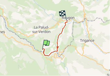
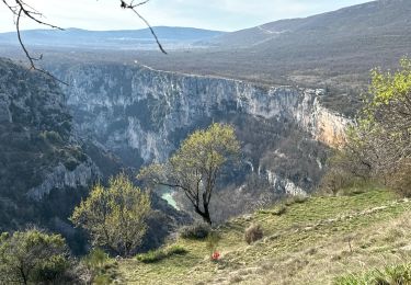
Trail Walking of 17.5 km to be discovered at Provence-Alpes-Côte d'Azur, Alpes-de-Haute-Provence, La Palud-sur-Verdon. This trail is proposed by MarieFrancoise.
Magnifique rando incontournable absolument à faire si vous n 'avez pas le vertige ! prendre une frontale et une veste pour les tunnels )
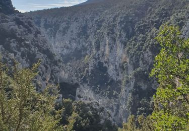
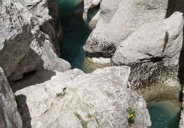
départ du chalet de la Maline après La Palud sur Verdon. Sentier très bien balisé. on surplombe les gorges du Verdon ,les falaises abruptes sont magnifiques .le chemin est tantôt ombragé tantôt au soleil.
on descend en lacets pour se rapprocher du Verdon
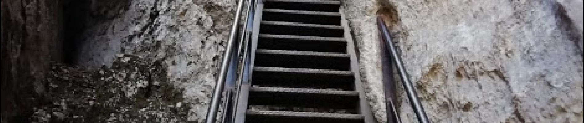
On arrive ensuite à la brèche d ' Imbert ( 6 échelles de 252 marches soit un dénivelé de de 100 m )
Continuer juqu' au 1er des 3 tunnels celui des baumes que l 'on laissera sur la gauche. Poursuivre juqu'au 2 ème tunnel de Trescaire long de 110m et enfin emprunter le 3ème tunnel celui du Baou long de 670 m
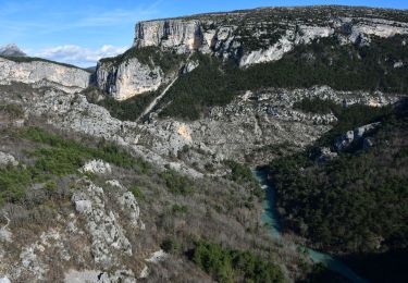
continuer jusqu 'a un parking et là prendre le sentier montant vers le point sublime. Magnifique panorama sur le grand canyon et vous y trouverez la stèle de Blanc .Il y a également un café restaurant.
remarque : nous avons dû rentrer avec d autres marcheurs ayant fait la rando à l envers car notre voiture était garée au Chalet de la Maline et que la navette sur laquelle nous avions compté n 'était pas là
 - Photo 1")
 - Photo 2")
 - Photo 3")
 - Photo 4")
 - Photo 5")
 - Photo 6")
 - Photo 7")
 - Photo 8")
 - Photo 9")
 - Photo 10")
 - Photo 11")
 - Photo 12")
 - Photo 13")
 - Photo 14")
 - Photo 15")
 - Photo 16")
 - Photo 17")
 - Photo 18")
 - Photo 19")
 - Photo 20")
57 photos in total. Please click on a photo to see them all in the gallery.

Walking

Walking

Walking
Walking
Walking
Walking
Walking
Walking
Walking